
For questions about municipal activities such as zoning, land-use, permits, incentives
Regional Municipality of Wood Buffalo 780-743-7000 | [email protected] https://www.rmwb.ca/en/index.aspx
Overview
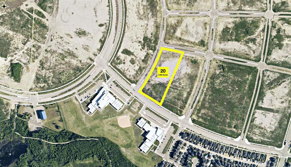
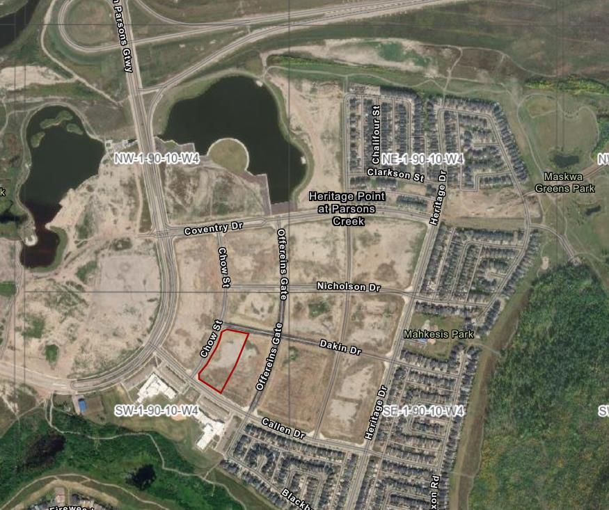
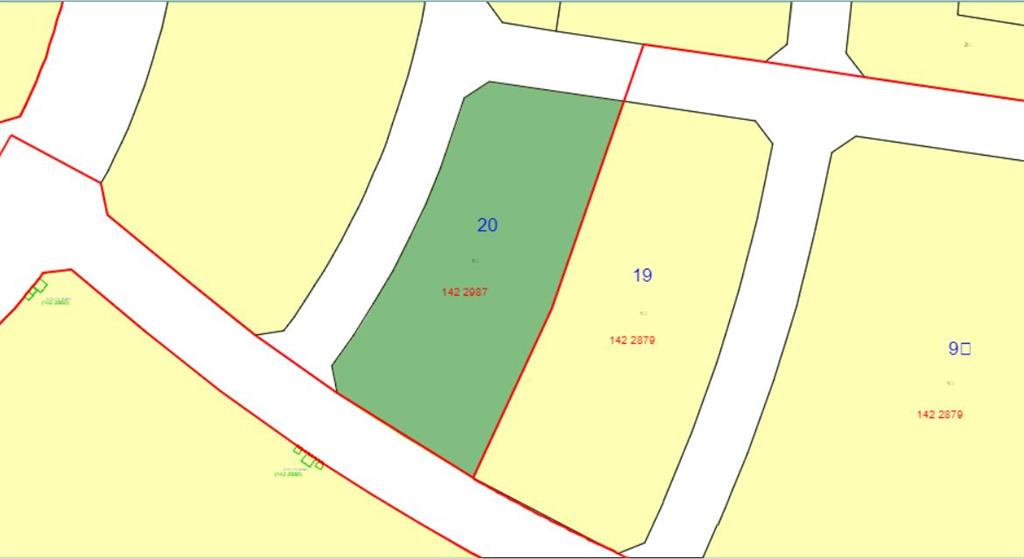
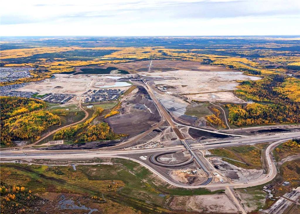
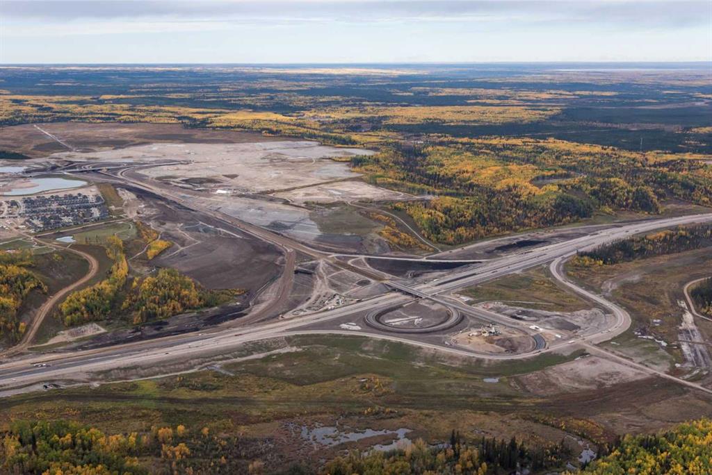
New opportunities are taking root in the community of North Parsons Creek. Discover a remarkable Land Development opportunity. Parcel 20, situated on Heritage Drive, boasts an expansive 3.48 Acres (+/-) of land zoned MD Main Street District. The parcel is provided with full municipal services in relatively close proximity to the property line, including water, natural gas, sewer and power. Seated on a scenic plateau overlooking the Athabasca River Valley stands the community of North Parsons Creek. Parsons Creek is located west of the Athabasca River valley and Hwy 63 and north of the existing Timberlea residential subdivision. Parsons North is a Master Planned development designed as a multi-phased integrated community that promotes a high quality of life for residents through a pedestrian-friendly environment and a variety of transportation, housing, commercial, and future recreational options. Parsons Creek’s design offers a walkable, vibrant, mixed-use environment with good connections to adjacent neighbourhoods. Focus on sustainable principles such as mixed-use areas, extensive trail systems, pedestrian connections, and transit nodes; Parsons Creek has been designed to encourage sustainable development and lifestyles. This trendy suburban location features an ideal combination of residential opportunities with connected open spaces, two elementary schools, and future commercial/retail development. Signature traits include an abundance of parks, paved trails, a skate park, a water spray park, and a future waterfront village with a canal and two man-made ponds. The population of Parsons Creek in 2021 was 3,880, with 1,727 dwellings according to a municipal census conducted by the R.M. of Wood Buffalo. Once built out, this growing neighbourhood will be home to 24,000 residents on over 815 acres of land. *Permitted uses and servicing are to be verified by the purchaser with the RMWB.
Details
Available Space:
3ac
Price:
$2,700,000
Location Street Address:
Plan 1422987 Block 20 Lot 1
Property Types:
Land
Infrastructure Details
Note: distances are in straight line, rather than driving distances
Note: distances are in straight line, rather than driving distances
Nearest highways:
- Highway 63 - 2.26 km (High Load Corridor)
- Highway 881 - 29.81 km (High Load Corridor)
- Highway 858 - 208.97 km
Nearest hospital:
- Northern Lights Regional Health Centre - 8.76 km
Nearest airports:
- International: Fort McMurray International Airport - 19.76km
Nearest powerlines:
- ATCO - 7L165 144kv - 1.47 km
Nearest substations:
- PARSONS CREEK - 718S , ATCO - 1.74 km
Nearest irrigation systems:
- Within 634.74 km
Nearest railways:
- Canadian National, Class : Main - 26.31 km
Nearest gas franchise area:
- ATCO Gas - Fort Mcmurray
Nearest Power Plant:
-
Poplar Creek (STG 3) (SCR5), Suncor Energy Inc. - 25.23 km
Cogeneration, 376 (69) MW
Fibre Internet Availability:
- Ready/Available
- Availability is estimated. Contact an internet service provider for more information.
Nearest Rail Terminals
| Type | Name | Operated By | Types of Products Shipped | Distance |
|---|---|---|---|---|
| Transload | CN Fort McMurray | CN DISTRIBUTION CENTRE |
|
25.96 KM |
| Grain | CP Star | Viterra |
|
339.7 KM |
| Transload | CP Lamont County | Alberta Midland Railway Terminal |
|
342.49 KM |
| Grain | CN Lamont Grain Terminal | Richardson Pioneer Ltd. |
|
345.66 KM |
| Transload | Alberta Midland Rail Terminal | Canadian Northern Plains Rail Services |
|
344.73 KM |
Highways
Airports
Railways
Rail Stations
Powerlines
Substations
Irrigation
Community Economic Highlights: Wood Buffalo, AB

Fort McMurray International Airport is located within Wood Buffalo, offering domestic flights Edmonton, Calgary and Toronto.

With its large oil sands operations, Wood Buffalo is a global leader in oil production.

Wood Buffalo has a median family income of $200,000 compared to the Alberta median of $96,000.
Community Economic Details: Wood Buffalo, AB
Click on a tile to open the indicator page and view more details.
| Site Data Provided by: | Pillar9 ™ |
| The information provided on property listing pages is sourced from third-party data providers. While we make every effort to ensure the accuracy of the information presented, we cannot guarantee its completeness or correctness. Users are advised to conduct their own due diligence and verify all details independently. The Government of Alberta, its agencies, and affiliates shall not be held liable for any inaccuracies or omissions in the property listings or for any actions taken in reliance on the information provided herein. Use of the information provided on property listing pages is at all times subject to the terms of the Disclaimer and Terms of Use. | |