
For questions about municipal activities such as zoning, land-use, permits, incentives
Lethbridge County 403-328-5525 | [email protected] https://www.lethcounty.ca
Overview
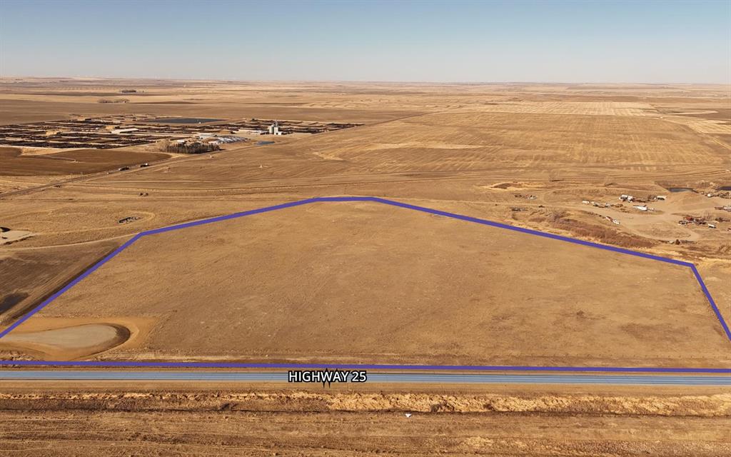
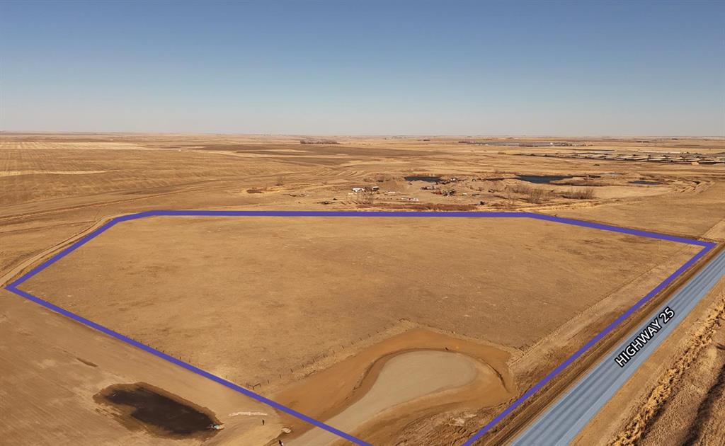
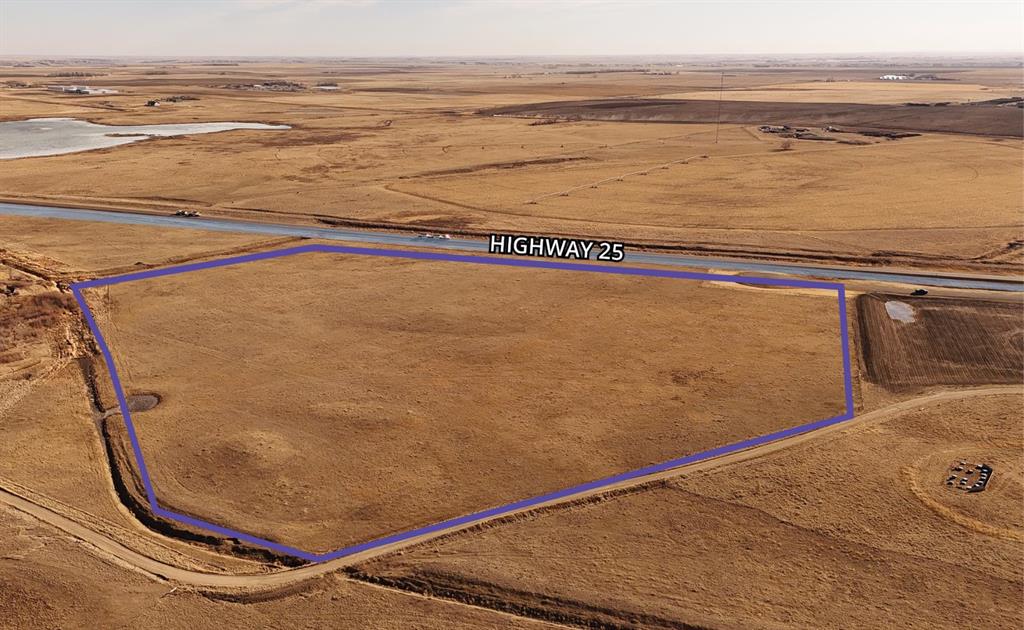
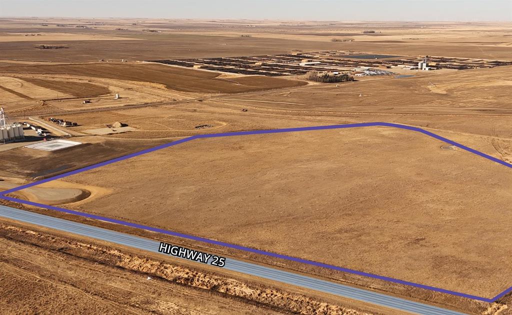
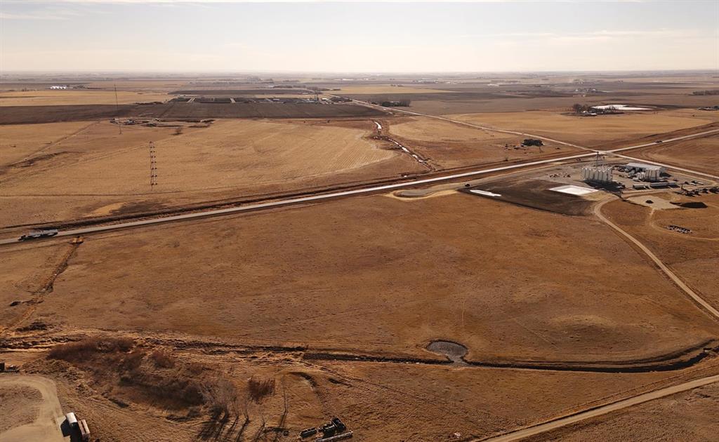
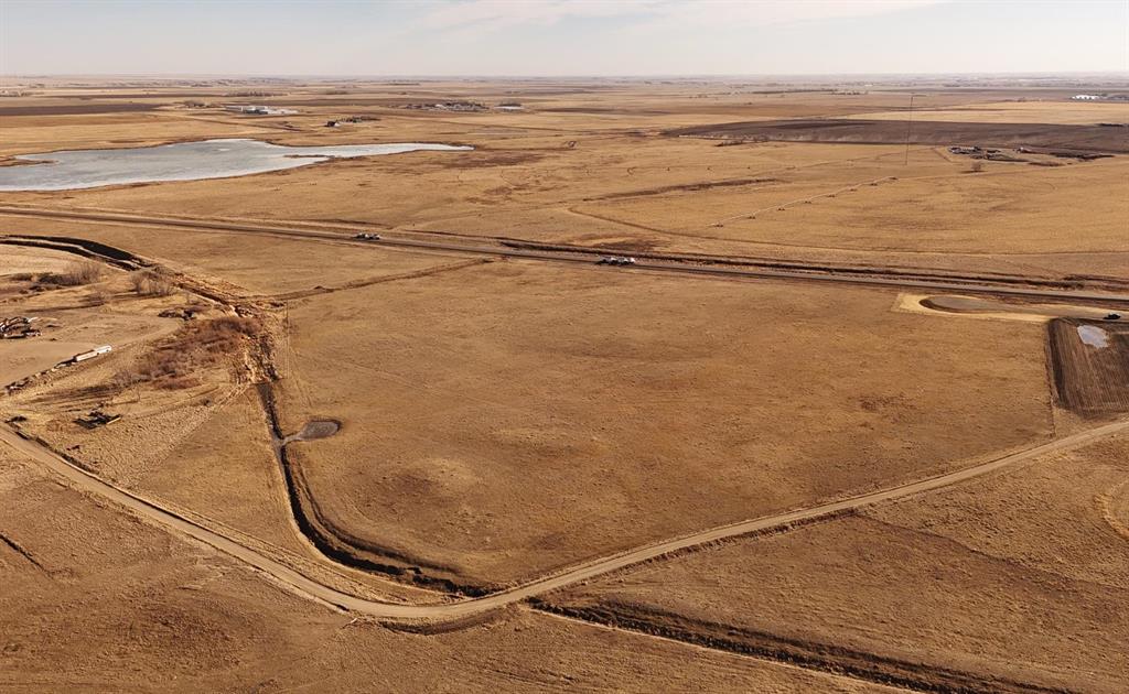
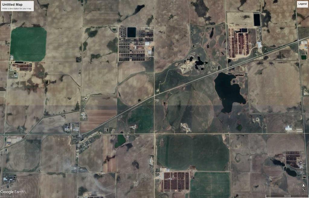
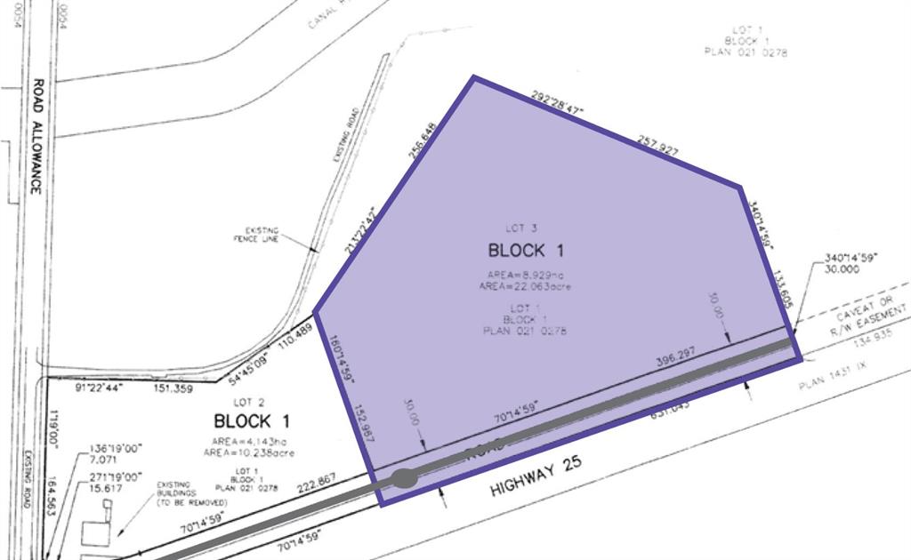
This newly subdivided Rural General Industrial zoned parcel is a great opportunity to secure well-priced land in Lethbridge County. With a new road allowance completed in 2025, the site offers strong visibility, easy access, and plenty of room for flexible site development. Its size and location along Highway AB-25 make it a strong fit for logistics operations or agricultural support services. As part of Lethbridge County, the property benefits from lower municipal tax rates compared to the City of Lethbridge. The parcel will remain at the agriculture mill rate until development and change of use are completed, helping reduce holding costs. The combination of flexibility, competitive pricing, and industrial zoning makes this an attractive option in a market where rural industrial land is increasing in value. Located along Highway AB-25, just two miles west of the Highway AB-845 intersection to Coaldale and one mile east of Iron Springs, this parcel offers a convenient rural position with easy regional reach. Lethbridge County area is known for its strong agricultural base and growing industrial operations. With access to the provincial secondary highway network, this location offers businesses practical access to Lethbridge and surrounding area without the higher costs of operating in the city’s urban industrial zones.
Details
Available Space:
22ac
Price:
$1,210,000
Location Street Address:
AB-25 AB-25 Highway
Property Types:
Land
Infrastructure Details
Note: distances are in straight line, rather than driving distances
Note: distances are in straight line, rather than driving distances
Nearest highways:
- Highway 25 - Less than 1 km (High Load Corridor)
- Highway 845 - 2.84 km (High Load Corridor)
- Highway 519 - 7.62 km (High Load Corridor)
- Highway 843 - 8.59 km (High Load Corridor)
- Highway 521 - 13.63 km
Nearest hospital:
- Coaldale Health Centre - 24.24 km
- Chinook Regional Hospital - 30.63 km
- Taber Health Centre - 39.62 km
- Raymond Health Centre - 53.02 km
- Vulcan Community Health Centre - 66.25 km
Nearest airports:
- Regional: Lethbridge County Airport - 36.04km
- International: Calgary International Airport - 162.2km
Nearest powerlines:
- AltaLink - 1005L 240kv, Double Circuit w/ 1041L - 4.55 km
Nearest substations:
- UPLANDS - 241S , City of Lethbridge - 24.27 km
- PICTURE BUTTE - 120S , AltaLink - 13.78 km
Nearest irrigation systems:
- Within 0.39 km
Nearest railways:
- Canadian Pacific, Class : Main - 23.85 km
Nearest gas franchise area:
-
Within 651.16 m
Service Area: ATCO Gas – ATCO Natural Gas Distribution Customer Correspondence
Nearest Power Plant:
-
COL1 Coaldale (COL1), Concord Coaldale Partnership - 15.99 km
Solar, 23 MW
Fibre Internet Availability:
- Extensible
- Availability is estimated. Contact an internet service provider for more information.
Nearest Rail Terminals
| Type | Name | Operated By | Types of Products Shipped | Distance |
|---|---|---|---|---|
| Transload | CP Coaldale | 5 Suns Transloading Ltd. |
|
23.69 KM |
| Yard | CP Lethbridge Yard | Canadian Pacific |
|
26.94 KM |
| Yard | CP Kipp Yard Coalhurst | Canadian Pacific |
|
29.21 KM |
| Grain | CP Lethbridge | Cargill |
|
30.52 KM |
| Transload | CP Monarch | More Than Just Feeds |
|
35.5 KM |
Highways
Airports
International
Regional
Local
Railways
Rail Stations
Powerlines
Substations
Irrigation
Community Economic Highlights: Lethbridge County, AB

8 high load corridors pass through Lethbridge County, and Lethbridge Airport is located there.

Leduc County has a median family income of $130976.2623 compared to the Alberta median of $119,100

Lethbridge County is a leader in agriculture compared to other municipalities in Alberta.
Community Economic Details: Lethbridge County, AB
Click on a tile to open the indicator page and view more details.
| Site Data Provided by: | Pillar9 ™ |
| The information provided on property listing pages is sourced from third-party data providers. While we make every effort to ensure the accuracy of the information presented, we cannot guarantee its completeness or correctness. Users are advised to conduct their own due diligence and verify all details independently. The Government of Alberta, its agencies, and affiliates shall not be held liable for any inaccuracies or omissions in the property listings or for any actions taken in reliance on the information provided herein. Use of the information provided on property listing pages is at all times subject to the terms of the Disclaimer and Terms of Use. | |