For questions about municipal activities such as zoning, land-use, permits, incentives
Reade Beaudoin, Senior Economic Development Officer, Strathcona County 780-464-8095 | [email protected] https://www.selectstrathcona.com
Overview
See Full Listing
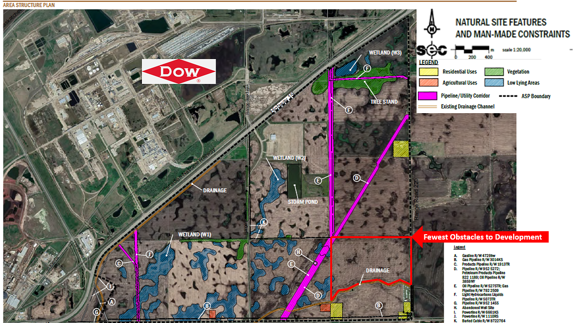
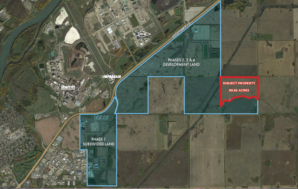
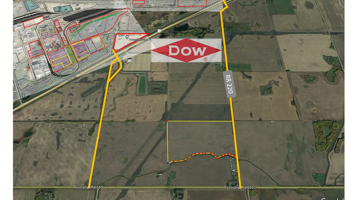
• 99.86 Acres (+/-) • Located 1.5 Km from Airport CFB6 Edmonton / Josephburg Airport • Vendor Financing is Available • Josephburg Road North Industrial Area Structure Plan • Vendor Willing to sell Smaller Portions of Land as little as 20 Acres (Purchase will be Responsible for Subdivision and Servicing Costs)
Building Overview
Address: RR 220, N of Township Road 550, Fort Saskatchewan, AB Legal Address: SE 1 55 22 4 Total Size: 99.86 Acres (+/-) Zoning: Future Industrial Land Possession: Immedicate/Negotiable Sale Price: $125,000/Acre
Details
Available Space:
100ac
Price:
Contact
Location Street Address:
Fort Saskatchewan Industrial Land
Lot Size:
99.86 AC
Lot Size Units:
AC
Space Types:
Land
Property Types:
Land
Infrastructure Details
Note: distances are in straight line, rather than driving distances
Note: distances are in straight line, rather than driving distances
Nearest highways:
- Highway 830 - 1.64 km (High Load Corridor)
- Highway 16 - 8.9 km (High Load Corridor)
- Highway 824 - 9.62 km
- Highway 15 - 10.25 km (High Load Corridor)
- Highway 630 - 15.39 km
Nearest hospital:
- Fort Saskatchewan Community Hospital - 8.79 km
Nearest airports:
- International: Edmonton International Airport - 49.57km
Nearest Historic Site
- Historic site designation: 5a
- HRV(5): high potential to contain a historic resource
- Category (a): archaeological
Nearest powerlines:
- AltaLink - 706L 138kv - 8.2 km
Nearest substations:
- WESTWOOD - 422S , AltaLink - 7.18 km
Nearest railways:
- Canadian Pacific, Class : Main - 3.99 km
Nearest gas franchise area:
-
Within 875.98 m
Service Area: ATCO Gas – ATCO Natural Gas Distribution Customer Correspondence
Nearest Power Plant:
-
Dow Hydrocarbon (GT-101 GT-102) (DOWG), Dow Chemical Canada ULC - 10.73 km
Cogeneration, 326 (180) MW
Fibre Internet Availability:
- Extensible
- Availability is estimated. Contact an internet service provider for more information.
Nearest Rail Terminals
| Type | Name | Operated By | Types of Products Shipped | Distance |
|---|---|---|---|---|
| Transload | CN Scotford | CN DISTRIBUTION CENTRE |
|
13.88 KM |
| Transload | CP Sherwood Park | Akenside TFR |
|
11.4 KM |
| Yard | CP Scotford Yard | Canadian Pacific |
|
18.23 KM |
| Grain | CP Gaudin | Providence Grain |
|
17.07 KM |
| Grain | CN Gaudin Grain Terminal | Providence Grain Group Inc. |
|
17.19 KM |
Highways
Airports
International
Regional
Local
Railways
Rail Stations
Powerlines
Substations
Irrigation
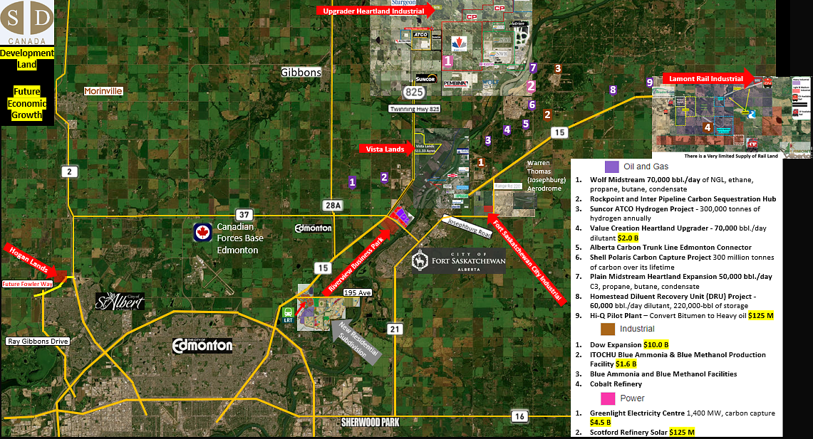
Community Economic Highlights: Strathcona County, AB

Strathcona County is home to Alberta's Industrial Heartland, Canada's largest hydrocarbon processing region.

Six rail terminals and seven high load corridors are located within Strathcona County.

Median family income stands at $144,000 in Strathcona County, significantly above Alberta's median of $115,000.
Community Economic Details: Strathcona County, AB
Click on a tile to open the indicator page and view more details.
| Site Data Provided by: |
|
| The information provided on property listing pages is sourced from third-party data providers. While we make every effort to ensure the accuracy of the information presented, we cannot guarantee its completeness or correctness. Users are advised to conduct their own due diligence and verify all details independently. The Government of Alberta, its agencies, and affiliates shall not be held liable for any inaccuracies or omissions in the property listings or for any actions taken in reliance on the information provided herein. Use of the information provided on property listing pages is at all times subject to the terms of the Disclaimer and Terms of Use. | |