For questions about municipal activities such as zoning, land-use, permits, incentives
Lethbridge County 403-328-5525 | [email protected] https://www.lethcounty.ca
Overview
See Full Listing
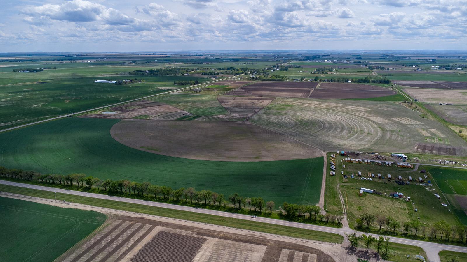
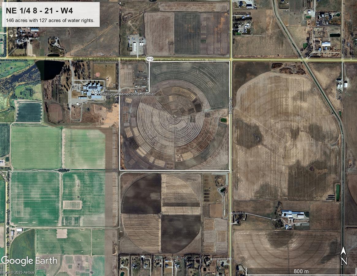
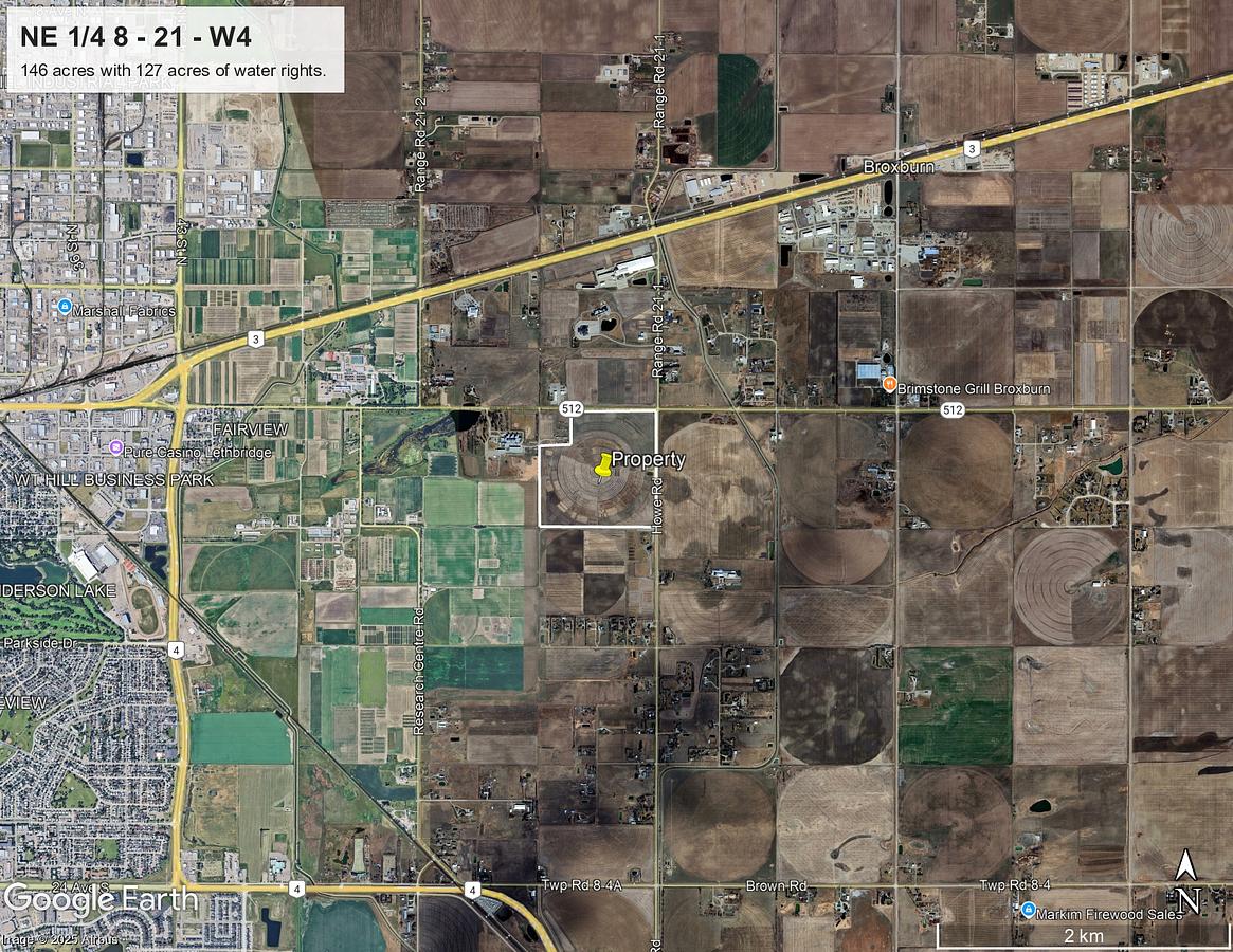
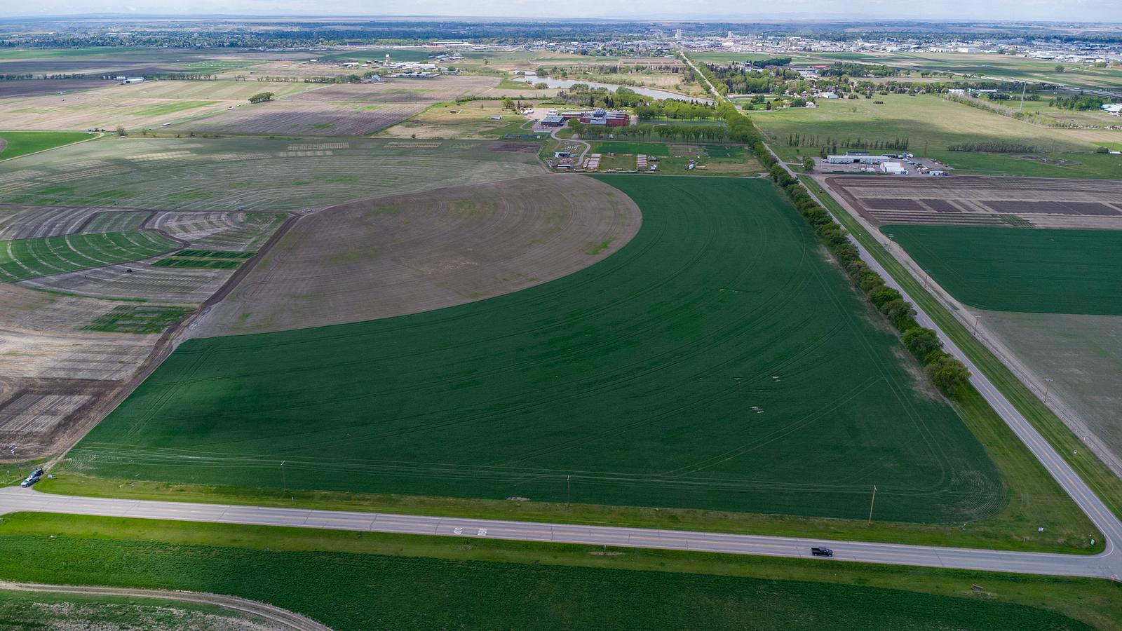
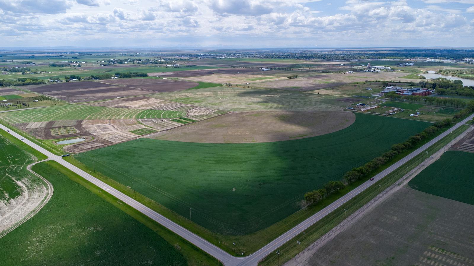
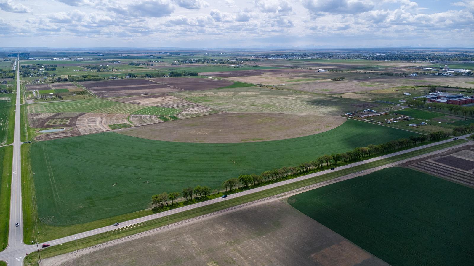
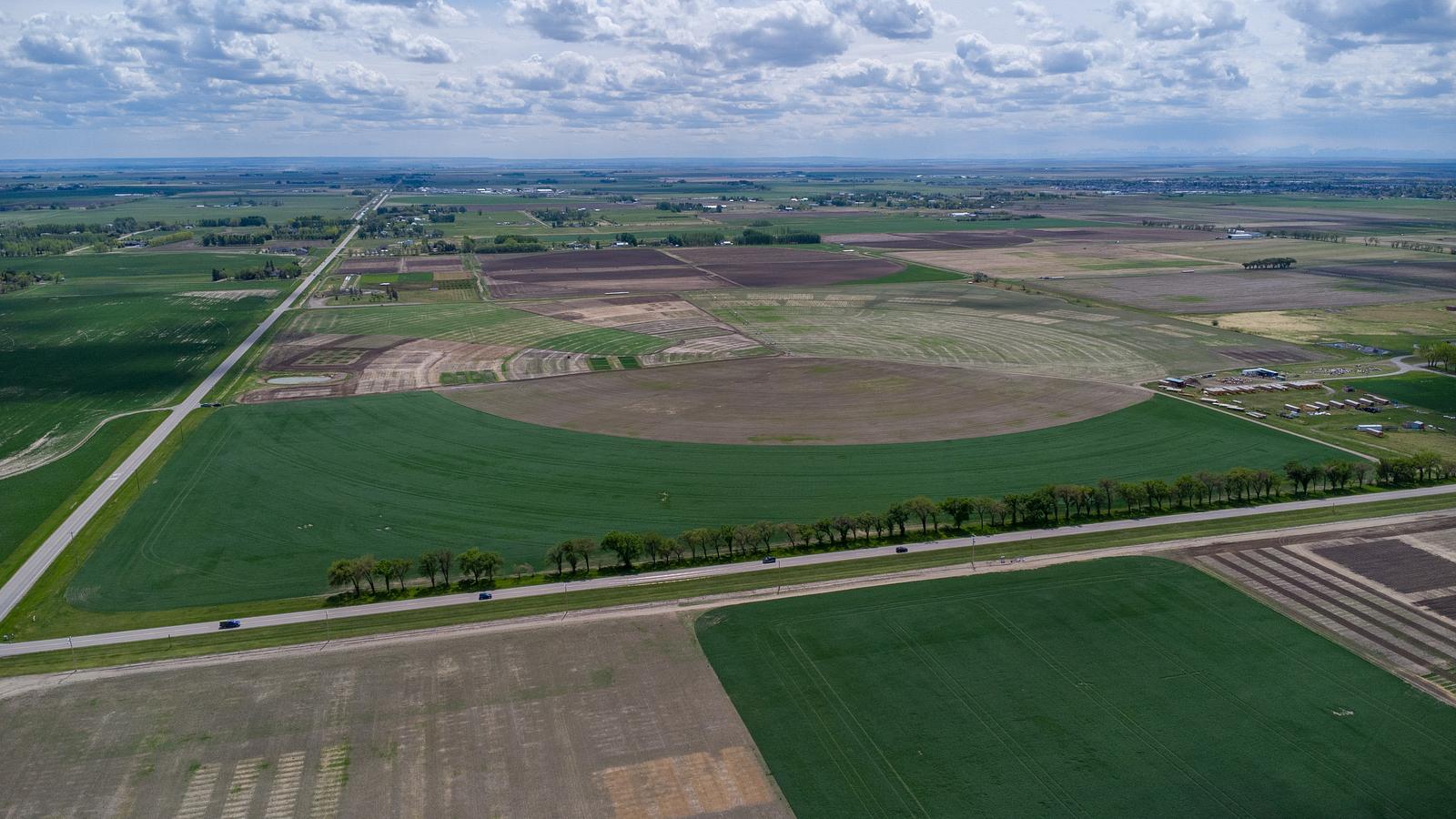
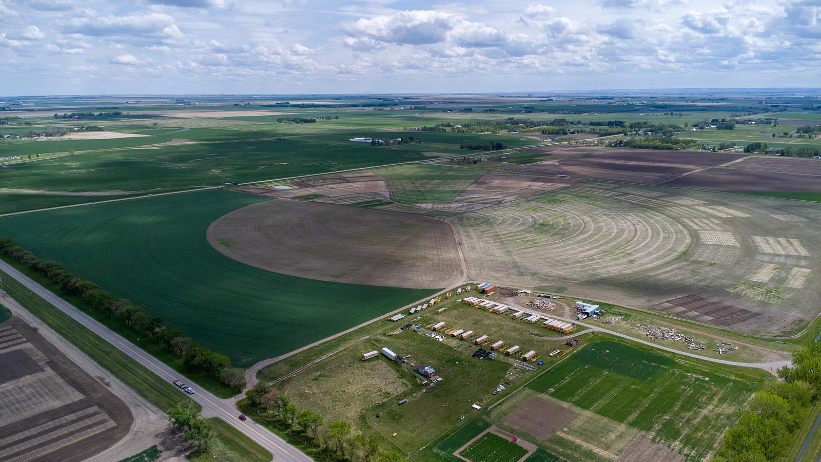
Agriculture or Future Development! 146 Acres located just outside of Lethbridge City Limits. Corner of Howe and jail road. Unlock the potential of this prime piece of agriculture land or future development land—perfect for forward-thinking investors, builders, or developers. With development already booming in the area, this land offers incredible potential. Whether you’re thinking country residential, multi-family, or commercial—the possibilities are endless.
Building Overview
Included in price is 127 Acres of water rights, 2020 Zimmatic pivot, 3 PH Power, Electric Pump.
Details
Available Space:
146ac
Price:
$8,500,000
Location Street Address:
County of Lethbridge
Lot Size:
146.0 AC
Lot Size Units:
AC
Space Types:
Land
Property Types:
Land
Infrastructure Details
Note: distances are in straight line, rather than driving distances
Note: distances are in straight line, rather than driving distances
Nearest highways:
- Highway 512 - Less than 1 km (High Load Corridor)
- Highway 3 - 1.62 km (High Load Corridor)
- Highway 4 - 2.88 km (High Load Corridor)
- Highway 5 - 5.28 km
- Highway 508 - 9.18 km
Nearest hospital:
- Chinook Regional Hospital - 5.73 km
Nearest airports:
- Regional: Lethbridge County Airport - 8.31km
- International: Calgary International Airport - 182.55km
Nearest powerlines:
- City of Lethbridge - 824L 138kv - 3.06 km
Nearest substations:
- NORTH LETHBRIDGE - 370S , AltaLink - 8.05 km
- MACDONALD - 146S , City of Lethbridge - 3.77 km
Nearest irrigation systems:
- Within 1.05 km
Nearest railways:
- Canadian Pacific, Class : Main - 1.68 km
Nearest gas franchise area:
-
Within 486.09 m
Service Area: ATCO Gas – ATCO Natural Gas Distribution Customer Correspondence
Nearest Power Plant:
-
COD1 Coaldale (COD1), Signalta Resources Limited - 13.64 km
Cogeneration, 5 MW
Fibre Internet Availability:
- Ready/Available
- Availability is estimated. Contact an internet service provider for more information.
Nearest Rail Terminals
| Type | Name | Operated By | Types of Products Shipped | Distance |
|---|---|---|---|---|
| Yard | CP Lethbridge Yard | Canadian Pacific |
|
4.15 KM |
| Grain | CP Lethbridge | Cargill |
|
7.5 KM |
| Transload | CP Coaldale | 5 Suns Transloading Ltd. |
|
9.63 KM |
| Grain | CP Lethbridge | Viterra |
|
12.56 KM |
| Grain | CP Wilson | Parrish & Heimbecker Ltd |
|
12.56 KM |
Highways
Airports
International
Regional
Local
Railways
Rail Stations
Powerlines
Substations
Irrigation
Community Economic Highlights: Lethbridge County, AB

8 high load corridors pass through Lethbridge County, and Lethbridge Airport is located there.

Leduc County has a median family income of $130976.2623 compared to the Alberta median of $119,100

Lethbridge County is a leader in agriculture compared to other municipalities in Alberta.
Community Economic Details: Lethbridge County, AB
Click on a tile to open the indicator page and view more details.
| Site Data Provided by: |
|
| The information provided on property listing pages is sourced from third-party data providers. While we make every effort to ensure the accuracy of the information presented, we cannot guarantee its completeness or correctness. Users are advised to conduct their own due diligence and verify all details independently. The Government of Alberta, its agencies, and affiliates shall not be held liable for any inaccuracies or omissions in the property listings or for any actions taken in reliance on the information provided herein. Use of the information provided on property listing pages is at all times subject to the terms of the Disclaimer and Terms of Use. | |