Overview
See Full Listing
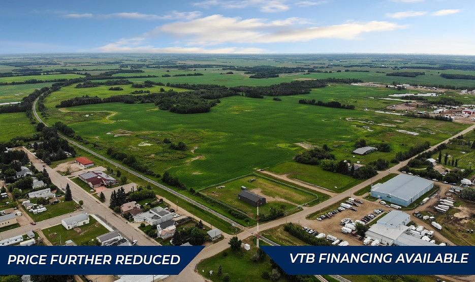
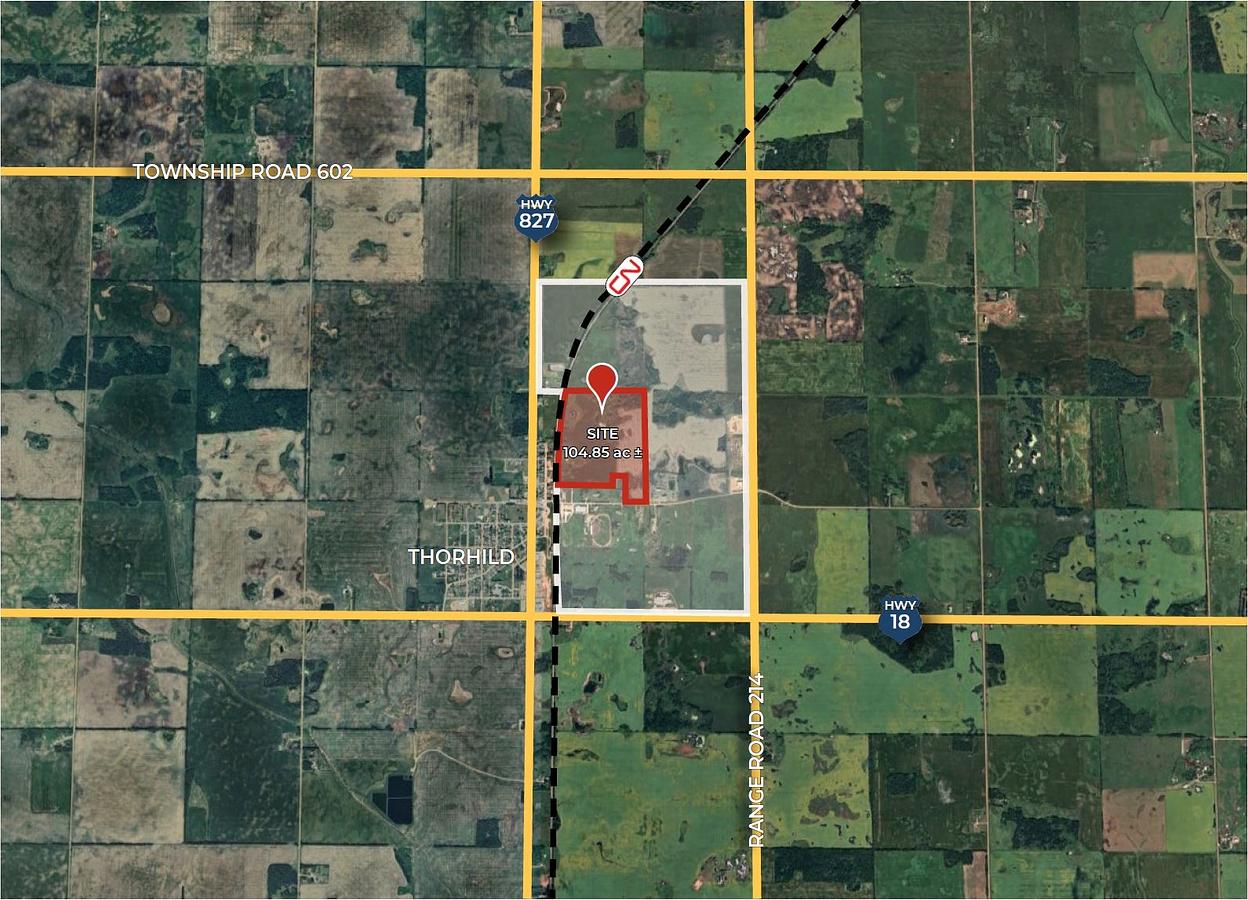
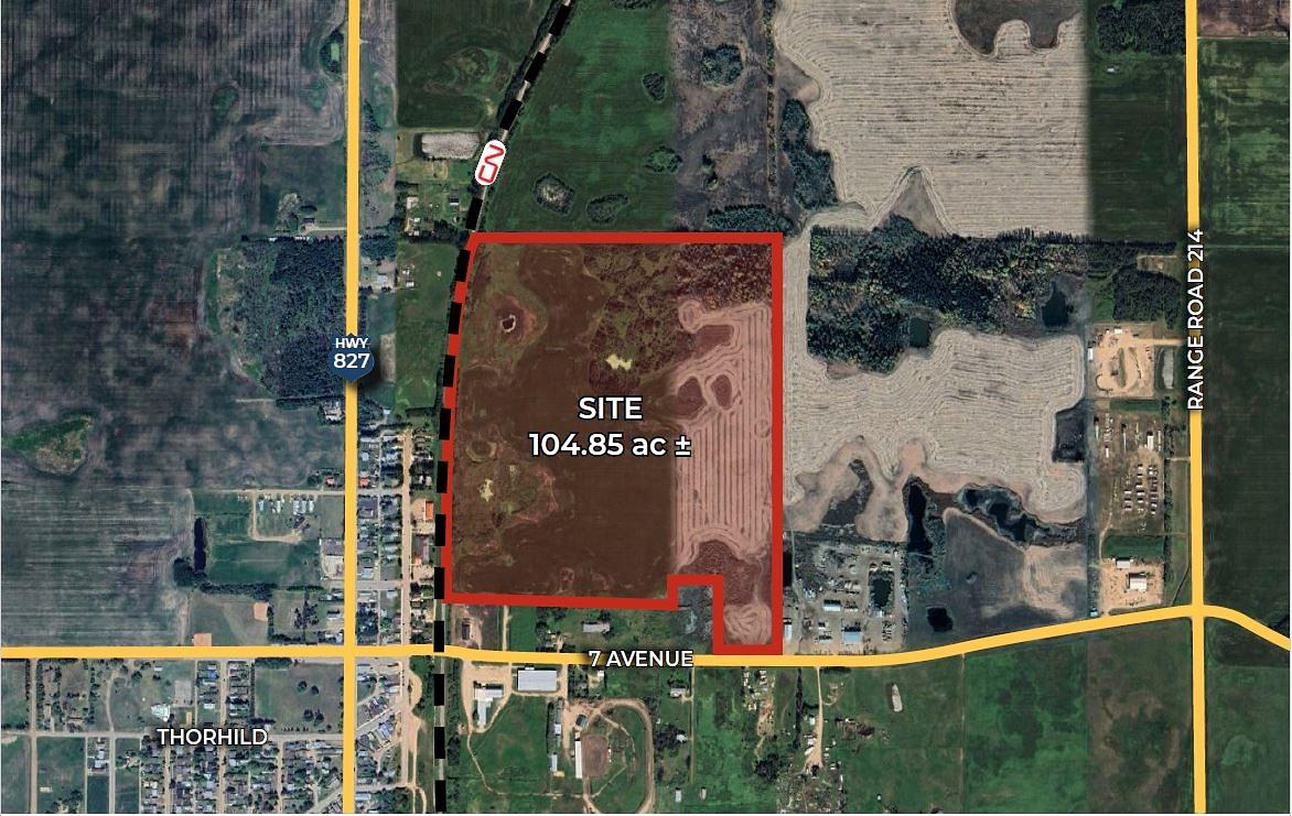
• Price further reduced with VTB financing available • Only 7 km from Highway 63, offering efficient access to major markets in northern and central Alberta. • Adjacent to CN Rail, with a potential railway connection, supported by an existing spur to the south. • M3 Industrial Zoning allows for a variety of manufacturing, logistics, and heavy industrial uses. • Existing water and sanitary mains located along 7th Avenue • Three proposed subdivision options • Strong infrastructure and utilities in place • Located near a high-load corridor, providing excellent routes for heavy industrial and transport operations.
Building Overview
MUNICIPAL ADDRESS Thorhild, Alberta LEGAL DESCRIPTION 4; 21; 60; 5; NW ZONING M3 (Industrial District) SITE AREA 104.85 Acres ± POSSESSION Negotiable
Details
Available Space:
105ac
Price:
$891,225
Location Street Address:
HWY 827
Space Zoning:
M3
Lot Size:
104.85 SF
Lot Size Units:
SF
Space Types:
Industrial / Land
Suite Floor:
1
Total Floors:
1
Property Types:
Industrial / Land
Property Zoning:
M3
Infrastructure Details
Note: distances are in straight line, rather than driving distances
Note: distances are in straight line, rather than driving distances
Nearest highways:
- Highway 827 - Less than 1 km
- Highway 18 - 1.32 km (High Load Corridor)
- Highway 63 - 5.93 km (High Load Corridor)
- Highway 28 - 15.7 km (High Load Corridor)
- Highway 661 - 18.11 km (High Load Corridor)
Nearest hospital:
- Redwater Health Centre - 23.84 km
Nearest airports:
- International: Edmonton International Airport - 99.87km
Nearest powerlines:
- AltaLink - 808L 138kv - 24.06 km
Nearest substations:
- WEASEL CREEK - 947S , ATCO - 19.97 km
- REDWATER - 171S , AltaLink - 25.61 km
Nearest railways:
- Canadian National, Class : Main - 0.41 km
Nearest gas franchise area:
- Thorhild County
Nearest Power Plant:
-
Redwater Cogen (45) (TC02), TransCanada Energy Ltd. - 38.14 km
Cogeneration, 92 (45) MW
Fibre Internet Availability:
- Ready/Available
- Availability is estimated. Contact an internet service provider for more information.
Nearest Rail Terminals
| Type | Name | Operated By | Types of Products Shipped | Distance |
|---|---|---|---|---|
| Yard | CP Scotford Yard | Canadian Pacific |
|
39.56 KM |
| Transload | CN Scotford | CN DISTRIBUTION CENTRE |
|
43.33 KM |
| Grain | CN Gaudin Grain Terminal | Providence Grain Group Inc. |
|
42.11 KM |
| Grain | CP Gaudin | Providence Grain |
|
42.26 KM |
| Transload | CP Fort Saskatchewan | Scotford TFR |
|
43.47 KM |
Highways
Airports
International
Regional
Local
Railways
Rail Stations
Powerlines
Substations
Irrigation
Community Economic Highlights: Thorhild County, AB

4 high load corridors pass through Thorhild County.

Thorhild County's workforce is specialized in Agriculture, Oil and Gas, and Wholesale Trade sectors.

Thorhild County is a business hub for Agriculture, Utilities, and Manufacturing in Alberta.
Community Economic Details: Thorhild County, AB
Click on a tile to open the indicator page and view more details.
| Site Data Provided by: |
|
| The information provided on property listing pages is sourced from third-party data providers. While we make every effort to ensure the accuracy of the information presented, we cannot guarantee its completeness or correctness. Users are advised to conduct their own due diligence and verify all details independently. The Government of Alberta, its agencies, and affiliates shall not be held liable for any inaccuracies or omissions in the property listings or for any actions taken in reliance on the information provided herein. Use of the information provided on property listing pages is at all times subject to the terms of the Disclaimer and Terms of Use. | |